Florida Memory is administered by the Florida Department of State, Division of Library and Information Services, Bureau of Archives and Records Management. The digitized records on Florida Memory come from the collections of the State Archives of Florida and the special collections of the State Library of Florida.
Westward Expansion refers to the gradual extension of the United States west. Immediately after the Revolutionary War, there were 13 states, mostly along the coast of the Atlantic. The Mississippi River marked the edge of America’s western territory, and Spanish Florida served as the country’s neighbor to the south. Westward Expansion began in 1803 with the Louisiana Purchase.
The United States doubled its size by purchasing Louisiana, which was much bigger than the modern-day state of Louisiana, from France. The original western border at the Mississippi River moved west toward the Rocky Mountains. The Indian Removal Act (1830) and the Mexican-American War also had a significant impact on the growth of the United States.
An important philosophy from this period of U.S. history was the doctrine of Manifest Destiny. Manifest Destiny was the belief that U.S. settlers were destined to spread throughout North America.
J.B. Poirson and J.B. Tardieu, Tardieu's Map of the Two Floridas and Lower Louisiana, 1807, Florida Memory, Florida Map Collection, FMC0229.
1803
Louisiana Purchase
In 1803, the United States purchased more than 800,000 square miles of territory from France for $15 million. The U.S. claimed that West Florida was included in the Louisiana Purchase, even though it was controlled by the Spanish at the time.
Explain major domestic and international economic, military, political, and socio-cultural events of Thomas Jefferson's presidency.
Examples may include, but are not limited to, Election of 1800, birth of political parties, Marbury v. Madison, judicial review, Jefferson's First Inaugural Address, Judiciary Act of 1801, Louisiana Purchase, Barbary War, Lewis and Clark Expedition, Hamilton and Burr conflict/duel, Embargo of 1807.
02/14
Supreme Court of the United States, Draft of Motion Rule for Marbury v. Madison, National Archives at Washington, DC, 1497352.
1803
Marbury v. Madison
Marbury v. Madison was a landmark Supreme Court case that established the principle of judicial review, which is the power of a court to decide whether a law or government decision is constitutional. Judicial review is an important part of the checks and balances system.
Learn More
"Marbury v. Madison (1803)," U.S. National Archives and Records Administration, last modified September 15, 2022.
Standards related to Thomas Jefferson's presidency
Explain major domestic and international economic, military, political, and socio-cultural events of Thomas Jefferson's presidency.
Examples may include, but are not limited to, Election of 1800, birth of political parties, Marbury v. Madison, judicial review, Jefferson's First Inaugural Address, Judiciary Act of 1801, Louisiana Purchase, Barbary War, Lewis and Clark Expedition, Hamilton and Burr conflict/duel, Embargo of 1807.
02/14
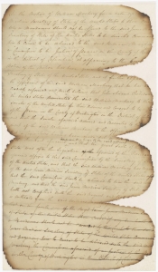
[Lewis and Clark at the Mouth of the Columbia River] 1805, 1906, Library of Congress, 2006683399.
May 14, 1804
Lewis and Clark Expedition Begins
On May 14, 1804, the Lewis and Clark Expedition left Camp Dubois (also called Camp Wood) just outside of St. Louis and began traveling up the Missouri River. The group was called the Corps of Discovery and included Captain Meriwether Lewis, Second Lieutenant William Clark, soldiers, civilians, and an enslaved man named York. It also famously included Sacagawea.
Learn More
"Lewis & Clark Expedition," U.S. National Archives and Records Administration, last modified June 2, 2021.
Identify roles and contributions of significant people during the period of westward expansion.
Examples may include, but are not limited to, Lewis and Clark, Sacagawea, York, Thomas Jefferson, Andrew Jackson, Tecumseh, Jean Baptiste Point Du Sable.
Explain the importance of the explorations west of the Mississippi River.
Examples may include, but are not limited to, Meriwether Lewis and William Clark, Zebulon Pike, John Fremont, the Mormon migration, the Forty-niners, the Oregon Trail.
Explain major domestic and international economic, military, political, and socio-cultural events of Thomas Jefferson's presidency.
Examples may include, but are not limited to, Election of 1800, birth of political parties, Marbury v. Madison, judicial review, Jefferson's First Inaugural Address, Judiciary Act of 1801, Louisiana Purchase, Barbary War, Lewis and Clark Expedition, Hamilton and Burr conflict/duel, Embargo of 1807.
Examine the experiences and perspectives of significant individuals and groups during this era of American History.
Examples may include, but are not limited to, Lewis and Clark, Sacajawea, York, Pike, Native Americans, Buffalo Soldiers, Mexicanos, Chinese immigrants, Irish immigrants, children, slaves, women, Alexis de Tocqueville, political parties.
02/14
An Army Bugler Blowing the Cavalry Charge in the Seminole War - Florida, 1848, Florida Memory, Reference Collection, RC06690.
1817
First Seminole War Begins
Spanish Florida offered enslaved people a refuge from slavery, which upset plantation owners near the border in Mississippi and Georgia. They would organize raids into Spanish Florida and attack the Seminole since many enslaved people joined or lived near Seminole towns. This eventually led to the First Seminole War when the U.S. War Department ordered General Andrew Jackson to attack the Seminole in 1817.
Examine key events and peoples in Florida history as each impacts this era of American history.
Examples may include, but are not limited to, Andrew Jackson's military expeditions to end Indian uprisings, developing relationships between the Seminole and runaway slaves, Adams-Onis Treaty, Florida becoming a United States territory, combining former East and West Floridas, establishing first state capital, Florida's constitution, Florida's admittance to the Union as 27th state.
02/14
John, Melish, J. Vallance, and Henry Schenck Tanner, Map of the United States of America: With the Contiguous British and Spanish Possessions, c1820, Library of Congress, 96686683.
February 22, 1819
Adams-Onís Treaty
The Spanish Empire ceded (or gave up control of) East and West Florida to the United States with the signing of the Adams-Onís Treaty on February 22, 1819. The treaty also defined the boundaries between the U.S. and New Spain, which included parts of what is now the Southwestern United States, Mexico and much of Central America.
Learn More
Ralph Blodgett, "Adams-Onís Treaty," in The Encyclopedia of Oklahoma History and Culture (Oklahoma Historical Society, 2010).
Standards related to westward expansion, key treaties, conflicts, and Florida's path to U.S. territory
Examine the causes, course, and consequences of United States westward expansion and its growing diplomatic assertiveness (War of 1812, Convention of 1818, Adams-Onis Treaty, Missouri Compromise, Monroe Doctrine, Trail of Tears, Texas annexation, Manifest Destiny, Oregon Territory, Mexican American War/Mexican Cession, California Gold Rush, Compromise of 1850, Kansas Nebraska Act, Gadsden Purchase).
Examine key events and peoples in Florida history as each impacts this era of American history.
Examples may include, but are not limited to, Andrew Jackson's military expeditions to end Indian uprisings, developing relationships between the Seminole and runaway slaves, Adams-Onis Treaty, Florida becoming a United States territory, combining former East and West Floridas, establishing first state capital, Florida's constitution, Florida's admittance to the Union as 27th state.
Describe Florida colonies that existed between the colonial period through the acquisition of Florida with the Adams-Onís Treaty of 1819, which was called the Transcontinental Treaty and ratified in 1821.
Explain how Florida (Adams-Onis Treaty) became a U.S. territory.
02/14
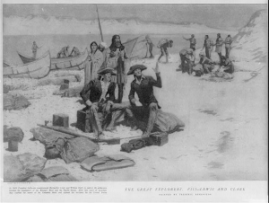
Mcconnell Map Co and James McConnell, The Missouri Compromise, 1820, [1919], Library of Congress, 2009581130.
March 6, 1820
President Monroe Signs the Missouri Compromise
The Missouri Compromise admitted Missouri to the Union as a slave state and Maine as a free state. It also outlawed slavery in the rest of the lands from the Louisiana Purchase north of the 36th parallel (an imaginary line 36 degrees north of the equator). This was meant to maintain an equal number of slave and free states in the U.S.
Learn More
"Missouri Compromise (1820)," U.S. National Archives and Records Administration, last modified May 10, 2022.
Standards related to early congressional actions regarding slavery, including the debate over its spread into western territories and Florida
Explain early congressional actions regarding the institution of slavery (i.e., Northwest Ordinance of 1787, Three-Fifths Compromise, Act Prohibiting Importation of Slaves of 1808).
Examine the causes, course, and consequences of United States westward expansion and its growing diplomatic assertiveness (War of 1812, Convention of 1818, Adams-Onis Treaty, Missouri Compromise, Monroe Doctrine, Trail of Tears, Texas annexation, Manifest Destiny, Oregon Territory, Mexican American War/Mexican Cession, California Gold Rush, Compromise of 1850, Kansas Nebraska Act, Gadsden Purchase).
Describe the debate surrounding the spread of slavery into western territories and Florida.
Examples may include, but are not limited to, abolitionist movement, Ft. Mose, Missouri Compromise, Bleeding Kansas, Kansas-Nebraska Act, Compromise of 1850.
02/14
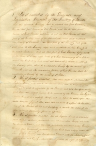
First Act of the Territorial Legislature, 1822, Florida Memory, State Archives of Florida, Series S222, s222_b001_01.
1822
First Act of Florida's Territorial Legislature
The United States established Florida's new government on March 20, 1822, by Congressional act. The first act of Florida's Territorial Legislature divided the territory into four counties and established local courts.
Examine key events and peoples in Florida history as each impacts this era of American history.
Examples may include, but are not limited to, Andrew Jackson's military expeditions to end Indian uprisings, developing relationships between the Seminole and runaway slaves, Adams-Onis Treaty, Florida becoming a United States territory, combining former East and West Floridas, establishing first state capital, Florida's constitution, Florida's admittance to the Union as 27th state.
02/14
Portrait Print of Joseph M. Hernandez, circa 1885, Florida Memory, Alvan S. Harper Collection, HA00133.
September 30, 1822
Joseph M. Hernández Becomes First Hispanic Congressman
On September 30, 1822, Joseph Marion Hernández became the first Hispanic American to serve in the United States Congress. He was the Territory of Florida's delegate in the House of Representatives from 1822 to 1823.
Examine key events and peoples in Florida history as each impacts this era of American history.
Examples may include, but are not limited to, Andrew Jackson's military expeditions to end Indian uprisings, developing relationships between the Seminole and runaway slaves, Adams-Onis Treaty, Florida becoming a United States territory, combining former East and West Floridas, establishing first state capital, Florida's constitution, Florida's admittance to the Union as 27th state.
02/14
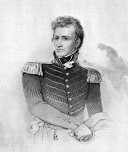
H.B. Hall, Andrew Jackson, circa 1900, Florida Memory, Political Collection, PT01326.
May 28, 1830
President Jackson Signs the Indian Removal Act
On May 28, 1830, President Andrew Jackson signed the Indian Removal Act into law. The act forced an estimated 60,000 to 100,000 Native people to leave their ancestral lands and move west of the Mississippi River. This forced march west was later called the Trail of Tears.
Identify key ideas and influences of Jacksonian democracy.
Examples may include, but are not limited to, political participation, political parties, constitutional government, spoils system, National Bank veto, Maysville Road veto, tariff battles, Indian Removal Act, nullification crisis.
02/14
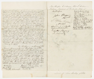
Treaty Between the United States and the Seminole Indians Signed at Payne's Landing, Ocklawaha River, Florida Territory, 9 May 1832, National Archives at Washington, DC, 146213769.
May 9, 1832
Treaty of Payne's Landing
On May 9, 1832, several Seminole leaders and the U.S. government signed a treaty demanding the Seminoles leave their home in Florida, which was not yet a U.S. state, and move west of the Mississippi River. This was part of the Trail of Tears.
Describe causes and effects of European colonization on the Native American tribes of Florida.
Examples may include, but are not limited to, protection of ships, search for gold, glory of the mother country, disease, death, and spread of religion.
Discuss the impact of colonial settlement on Native American populations.
Examples may include, but are not limited to, war, disease, loss of land, westward displacement of tribes causing increased conflict between tribes, and dependence on trade for Western goods, including guns.
02/14
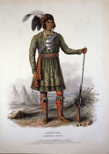
Daniel Rice and James G. Clark, Asceola, A Seminole Leader, 1842, Florida Memory, Reference Collection, RCN00471.
December 28, 1835
Second Seminole War Begins
Three years earlier, several Seminole leaders signed a treaty with the U.S. government agreeing to leave Florida, but other leaders disagreed and chose to stay and fight. On December 28, 1835, Seminole warriors attacked a group of U.S. troops moving through central Florida, which started the Second Seminole War.
Describe causes and effects of European colonization on the Native American tribes of Florida.
Examples may include, but are not limited to, protection of ships, search for gold, glory of the mother country, disease, death, and spread of religion.
Discuss the impact of colonial settlement on Native American populations.
Examples may include, but are not limited to, war, disease, loss of land, westward displacement of tribes causing increased conflict between tribes, and dependence on trade for Western goods, including guns.
02/14
James Wyld, Map of United States of America, 1845, Florida Memory, Florida Map Collection, FMC0303.
March 3, 1845
Florida Becomes a State
The Act establishing statehood for Iowa and Florida was approved on March 3, 1845, by the second session of the 28th United States Congress.
Learn More
"Statehood," Florida Department of State, accessed August 15, 2025.
Examine key events and peoples in Florida history as each impacts this era of American history.
Examples may include, but are not limited to, Andrew Jackson's military expeditions to end Indian uprisings, developing relationships between the Seminole and runaway slaves, Adams-Onis Treaty, Florida becoming a United States territory, combining former East and West Floridas, establishing first state capital, Florida's constitution, Florida's admittance to the Union as 27th state.
02/14
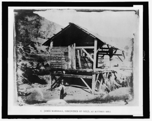
R. H. Vance, James Marshall, Discoverer of Gold, at Sutter's Mill, [1850?, printed 1948], Library of Congress, 2007676072.
January 24, 1848
California Gold Rush Begins
The California Gold Rush began on January 24, 1848, when James Marshall discovered gold at Sutter's Mill. In 1849, between 90,000 and 100,000 migrants arrived in California, leading to the nickname the "Forty-Niners." While many sought their fortunes in gold mines, others recognized the opportunity to start businesses and farms in the area.
Learn More
"The Discovery of Gold," in California as I Saw It: First-Person Narratives of California's Early Years, 1849 to 1900 (Library of Congress, n.d.).
Samantha Gibson, "California Gold Rush," Digital Public Library of America, last modified 2018.
Examine the causes, course, and consequences of United States westward expansion and its growing diplomatic assertiveness (War of 1812, Convention of 1818, Adams-Onis Treaty, Missouri Compromise, Monroe Doctrine, Trail of Tears, Texas annexation, Manifest Destiny, Oregon Territory, Mexican American War/Mexican Cession, California Gold Rush, Compromise of 1850, Kansas Nebraska Act, Gadsden Purchase).
02/14
Treaty of Guadalupe-Hidalgo [Exchange Copy], 2 February 1848, National Archives at Washington, DC, 299809.
February 2, 1848
Treaty of Guadalupe Hidalgo
The Mexican-American War began in 1846 as Mexico and the United States fought over who owned Texas. On February 2, 1848, representatives from both countries signed the Treaty of Guadalupe Hidalgo, ending the war. Mexico gave up more than half of its territory, including the land that became California, New Mexico, Nevada and Utah as well as parts of Arizona, Colorado, Oklahoma, Wyoming and Kansas.
Examine the causes, course, and consequences of United States westward expansion and its growing diplomatic assertiveness (War of 1812, Convention of 1818, Adams-Onis Treaty, Missouri Compromise, Monroe Doctrine, Trail of Tears, Texas annexation, Manifest Destiny, Oregon Territory, Mexican American War/Mexican Cession, California Gold Rush, Compromise of 1850, Kansas Nebraska Act, Gadsden Purchase).
02/14
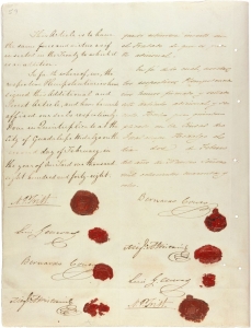
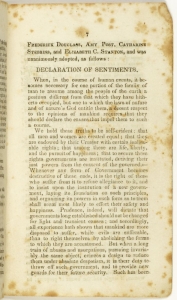
Image 10 of Report of the Woman's Rights Convention, Held at Seneca Falls, New York, July 19th and 20th, 1848. Proceedings and Declaration of Sentiments, Library of Congress, Miller NAWSA Suffrage Scrapbooks, 1897-1911, rbcmiller001106.
July 19, 1848
The Seneca Falls Convention
The first women's rights convention in America began on July 19, 1848, in Seneca Falls, New York. The 2-day convention included around 300 participants, including Frederick Douglass and Elizabeth Cady Stanton who read the Declaration of Sentiments to the group.
Examine the causes, course, and consequences of the women's suffrage movement (1848 Seneca Falls Convention, Declaration of Sentiments).
02/14
Charles Wilkes, J. H Young, and Sherman & Smith, Map of the Oregon Territory, [1844], Library of Congress, Atlas of the Narrative of the United States Exploring Expedition, 2004627252.
August 14, 1848
Congress Creates the Oregon Territory
On August 14, 1848, the United States Congress formally created the Oregon Territory, which included the modern-day states of Oregon, Washington and Idaho as well as parts of what is now Montana and Wyoming. Many immigrants traveled by wagon to the territory along a route commonly known as the Oregon Trail.
Examine the causes, course, and consequences of United States westward expansion and its growing diplomatic assertiveness (War of 1812, Convention of 1818, Adams-Onis Treaty, Missouri Compromise, Monroe Doctrine, Trail of Tears, Texas annexation, Manifest Destiny, Oregon Territory, Mexican American War/Mexican Cession, California Gold Rush, Compromise of 1850, Kansas Nebraska Act, Gadsden Purchase).
02/14
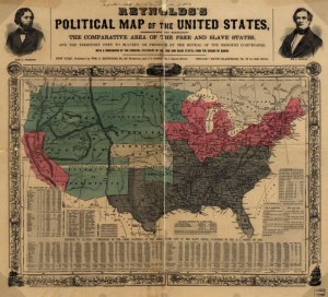
William C. Reynolds and J. C Jones, Reynolds's Political Map of the United States, Designed to Exhibit the Comparative Area of the Free and Slave States and the Territory Open to Slavery or Freedom by the Repeal of the Missouri Compromise, 1856, Library of Congress, 2003627003.
May 30, 1854
President Pierce Signs the Kansas-Nebraska Act
The Kansas-Nebraska Act recognized Kansas and Nebraska as U.S. territories and gave them the power to decide whether to allow slavery. This broke the Missouri Compromise by allowing slavery to spread north of the 36th parallel (an imaginary line 36 degrees north of the equator). The act also led to the creation of the Republican Party and played a key role in beginning the Civil War.
Learn More
"Kansas-Nebraska Act (1854)," U.S. National Archives and Records Administration, last modified June 14, 2024.
Standards related to westward expansion and slavery in the United States
Examine the causes, course, and consequences of United States westward expansion and its growing diplomatic assertiveness (War of 1812, Convention of 1818, Adams-Onis Treaty, Missouri Compromise, Monroe Doctrine, Trail of Tears, Texas annexation, Manifest Destiny, Oregon Territory, Mexican American War/Mexican Cession, California Gold Rush, Compromise of 1850, Kansas Nebraska Act, Gadsden Purchase).
Describe the debate surrounding the spread of slavery into western territories and Florida.
Examples may include, but are not limited to, abolitionist movement, Ft. Mose, Missouri Compromise, Bleeding Kansas, Kansas-Nebraska Act, Compromise of 1850.
Analyze the role of slavery in the development of sectional conflict.
Examples may include, but are not limited to, Abolition Movement, Nat Turner's Rebellion, Black Codes, Missouri Compromise, Compromise of 1850, Uncle Tom's Cabin, Kansas-Nebraska Act, Dred Scott v. Sandford, Lincoln-Douglas Debates, raid on Harpers Ferry, Underground Railroad, Presidential Election of 1860, Southern secession.
Explain how the rise of cash crops accelerated the growth of the domestic slave trade in the United States.
Clarification 1: Instruction includes the regions where cotton was produced.
Clarification 2: Instruction includes the purpose and impact of Eli Whitney’s cotton gin.
Clarification 3: Instruction includes how the demand for slave labor resulted in a large, forced migration.
Clarification 4: Instruction includes debates over the westward expansion of slavery (e.g., Louisiana Purchase, Missouri Compromise, Wilmot Proviso, Compromise of 1850, Kansas-Nebraska Act).
05/24
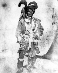
Seminole Chief, Billy Bowlegs, 1852, Florida Memory, Reference Collection, RC00958.
1855
The Third Seminole War Begins
When the U.S. continued to invade Seminole territory in late 1855, the Seminoles fought back. This led to the beginning of the Third Seminole War. At the end of the war, some of the remaining Seminoles, led by Billy Bowlegs, agreed to leave the area, and the U.S. government sent them to Oklahoma. Several bands remained in Florida.
Examine key events and peoples in Florida history as each impacts this era of American history.
Examples may include, but are not limited to, Andrew Jackson's military expeditions to end Indian uprisings, developing relationships between the Seminole and runaway slaves, Adams-Onis Treaty, Florida becoming a United States territory, combining former East and West Floridas, establishing first state capital, Florida's constitution, Florida's admittance to the Union as 27th state.
02/14
Commission to the Five Civilized Tribes, Map of Seminole Nation, 1902, Library of Congress, 2007627488.
1856
Seminole Nation of Oklahoma Recognized by U.S. Government
After the Treaty of Payne's Landing was signed in 1832, many Seminole left Florida for Indian Territory. Some left willingly while others were forcibly removed as part of the Trail of Tears. In 1856, the Seminole who lived in the west under Creek rule signed a treaty for independence with the Creek Nation and the U.S. government. They became the Seminole Nation of Oklahoma.
Learn More
"Into the West," Seminole Nation Museum, accessed December 11, 2025.
Andrew K. Frank, "Seminole (tribe)," in The Encyclopedia of Oklahoma History and Culture (Oklahoma Historical Society, 2010).
Examine the causes, course, and consequences of United States westward expansion and its growing diplomatic assertiveness (War of 1812, Convention of 1818, Adams-Onis Treaty, Missouri Compromise, Monroe Doctrine, Trail of Tears, Texas annexation, Manifest Destiny, Oregon Territory, Mexican American War/Mexican Cession, California Gold Rush, Compromise of 1850, Kansas Nebraska Act, Gadsden Purchase).
These primary source sets contain documents and photos arranged by topic that teachers can use in their lesson plans. Each set is accompanied by a teacher's guide containing historical context, teaching suggestions, and relevant NGSSS and Florida Standards.